No Booking, No Battery, No Backup Plan: How America Found Its Way Across the Country on a Wing and a Paper Map
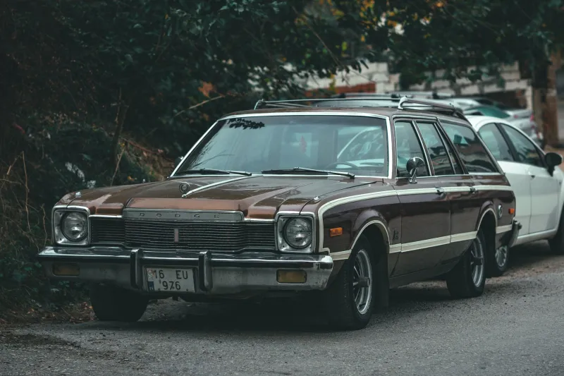
Picture this: it's June 1974, the station wagon is packed to the ceiling, and your father has just folded a gas station map along creases so worn they're practically translucent. That map — free, by the way, from any Gulf or Texaco station in America — is the entire navigation system for the next 2,600 miles. There's no app telling you traffic is heavy outside St. Louis. No algorithm suggesting a highly rated diner in Amarillo. Just a family, a highway, and a whole lot of not knowing.
We tend to remember the road trips of the 1960s through 1980s through a nostalgic haze, but the reality was genuinely different in ways modern travelers would find shocking. Let's take the long way through it.
The Map Was the Mission
The first thing to understand is that paper maps weren't a backup — they were the plan. AAA's TripTik booklets, those spiral-bound route guides, were sacred documents, assembled weeks in advance by a club agent who highlighted your route in yellow marker. Kids in the back seat became unofficial navigators, calling out towns two exits ahead like they were running a submarine.
And here's the part that gets lost: you could be genuinely, hopelessly lost. Not 'recalculating' lost. Truly lost, in a way that's nearly impossible today. Miss a turn near the outskirts of a strange city and you might circle for an hour, windows down, asking a stranger at a gas station who would give you directions that included phrases like 'past the old feed store, then hang a left where the Dairy Queen used to be.'
Getting lost was a tax you paid. But it was also where half the stories came from.
Reservations? Sometimes, If You Felt Like It
Today's traveler books a hotel six weeks out, checks the cancellation policy, and reads 340 reviews before committing. In 1978? Plenty of families drove until they got tired, then found a motel by the glow of its vacancy sign.
Holiday Inn and Motel 6 were building nationwide chains precisely because travelers wanted a reliable bet without booking ahead. You pulled in, asked the desk clerk for a room, negotiated in real time, and paid with a credit card run through a knuckle-buster machine that produced a carbon copy. If the town was full — say, during a state fair or a holiday weekend — you kept driving. The next town was always out there somewhere.
Dining worked the same way. You didn't consult a rating; you consulted the parking lot. A diner with a wall of pickup trucks outside was a good sign. A place with no cars at 6 p.m. told you everything you needed to know. The review system was called eyeballing it, and it worked surprisingly well.
The Roadside Was the Entertainment
Without screens to absorb every spare second, the road itself was the show. Families played the license plate game. They counted out-of-state plates, argued over the radio, and looked forward to the giant roadside attractions that once dotted American highways — the dinosaur parks, the mystery spots, the world's largest ball of twine in Cawker City, Kansas.
These weren't ironic stops. They were destinations, discovered by chance, often via a hand-painted billboard that started advertising 40 miles out. 'See Rock City' wasn't a slogan; it was an invitation, and barn roofs across the South carried it like a promise.
Compare that to a modern road trip: the route is optimized, the stops are pre-chosen, the podcasts are downloaded, and the lunch spot has a 4.7-star average. It's a better trip on paper. Nobody gets lost. Nobody eats a bad meal. And somewhere in that perfection, a certain category of memory quietly disappeared.
The Surprising Math of the Old Way
Here's a contrast that stings a little: a cross-country drive in 1970 took roughly the same number of days it takes now — five or six days of hard driving from New York to Los Angeles. The roads haven't gotten much faster. What's changed is everything around the driving.
A gallon of gas averaged about 36 cents in 1970 — roughly $2.90 in today's money, so not as cheap as memory suggests. Motel rooms ran $15 to $25 a night. But the real difference wasn't cost. It was friction. Every decision — where to sleep, where to eat, which route to take — was made on the fly, by people using judgment instead of data.
Today, the average traveler's phone makes hundreds of micro-decisions for them before the car leaves the driveway. The trip is smoother, safer, and easier to budget. It is also, in a real sense, pre-solved.
What the Detour Was Worth
Nobody is arguing we should throw our phones out the window. GPS has saved countless hours, and real-time weather alerts have made the road dramatically safer. That's progress, and it counts.
But there's a reason the road trip stories our parents and grandparents tell are never about the efficient stretch of I-80. They're about the wrong turn that led to a county fair, the diner with the pie that still gets mentioned at Thanksgiving, the night the motel was full and they slept at a truck stop outside Cheyenne. The mistakes were the souvenirs.
The old road trip was a negotiation with the unknown. The modern one is a confirmation of research. Both get you to the Grand Canyon. Only one of them leaves room for the unexpected story you'll still be telling decades later — and that, more than anything, is what changed between the paper map and the pin.